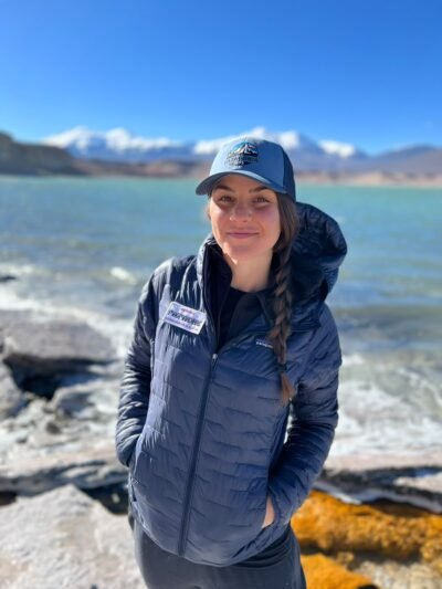
A day-by-day guide to hiking Peru’s Huayhuash Circuit: distances, altitude, acclimatization, and whether to go with a group or on your own.
How hard is the Huayhuash Circuit? How many days do you need? Do you need a guide? How will your body handle the altitude? And, honestly… could you do it?
It depends. (I know, I know. Eye roll. But stick with me!)
I’ll break it all down, but let’s start by imagining this.
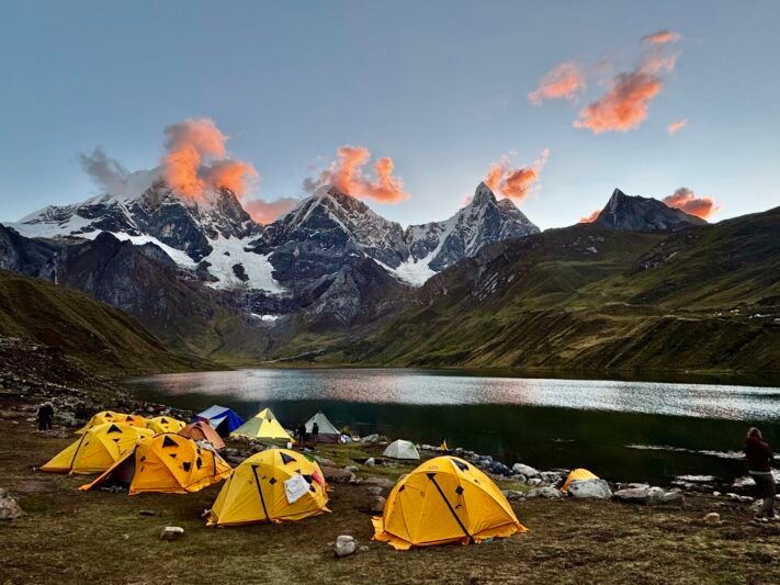
The wind finally goes still. We’re sitting on camp chairs at the edge of Laguna Carhuacocha, tea in hand, and nobody is talking. Yerupajá, Siula Grande, and Jirishanca rise straight out of the lake, and as the sun sets, the whole range shows up a second time, upside down, in the water. The peaks turn pink. Someone says dinner is ready. No one moves until the pink has faded.
The Huayhuash Circuit is one of those places that settles deep into your spirit. It brings together a combination of highlights that few places in this world can offer at once: heartbeat-skip worthy scenery of jagged, technical, pointy peaks with massive crevasse-filled glaciers spilling over them and turquoise alpine lakes underneath; the kinds of abundant mountain views that you can only get at high-altitude; non-technical hiking trails taking you through these seemingly unclimbable mountains; AND a rich culture of indigenous communities who co-exist in intimate connection with this land.
All of this, accessible to adventurous regular people.
Yes, that means you don’t need to be a mountain climber. Or be the fittest athlete. Or have high-altitude experience. Or be 25 years old.
I’ve walked it with women at various stages of life and I’ve watched each of them cross multiple 5,000-meter (16,400 ft) passes on their own two feet. Seeing people light up from the kinds of realizations that come from moving through places like this has become my life’s passion so, to help you figure out if this trek is for you, and how to set yourself up for success, this article will lay out the details that matter.
The Huayhuash Circuit at a glance
- Route: Depending on your time and fitness, choose between a mini trip that reaches a key highlight, a partial route that covers the most spectacular sections, or the full circuit.
- Trekking duration: 3–14 days, depending on the route you choose. This doesn’t include travel days or acclimatization.
- Acclimatization: 3–4 days of hikes around Huaraz
- Travel: 2–3 days to and from home, via Lima and Huaraz
- Highest points: passes around 5,000 m / 16,400 ft on the partial and full circuits
- Difficulty: Non-technical, but strenuous at altitude
- Best time to go: May to September (dry season)
The Huayhuash Circuit:
The Overlooked Younger Sibling With a Story of Its Own
Most people who come to Huaraz head straight for the famous Cordillera Blanca to climb some of the Andes’ most technical high-altitude peaks.
But just to the south sits its younger sibling, the Cordillera Huayhuash (why-wash), a compact range about 400 km / 250 mi north of Lima. For a mountain range, at about 30 km / 19 mi end to end, it’s small. But packed into that space are some of the most impressive mountains you’re ever going to see with your own eyes, including Yerupajá (6,635 m / 21,768 ft), the second-highest peak in Peru.
And what this range offers is something pretty unique: a high-altitude trekking circuit that brings you up close and personal with this level of mountain, without requiring any technical climbing. That, my friends, is why it’s known as one of South America’s most spectacular hikes, and an unforgettable one for anyone who has gone.
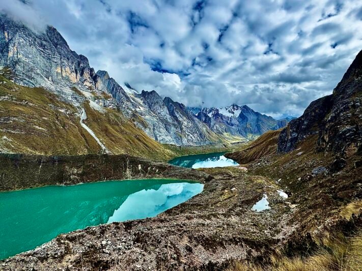
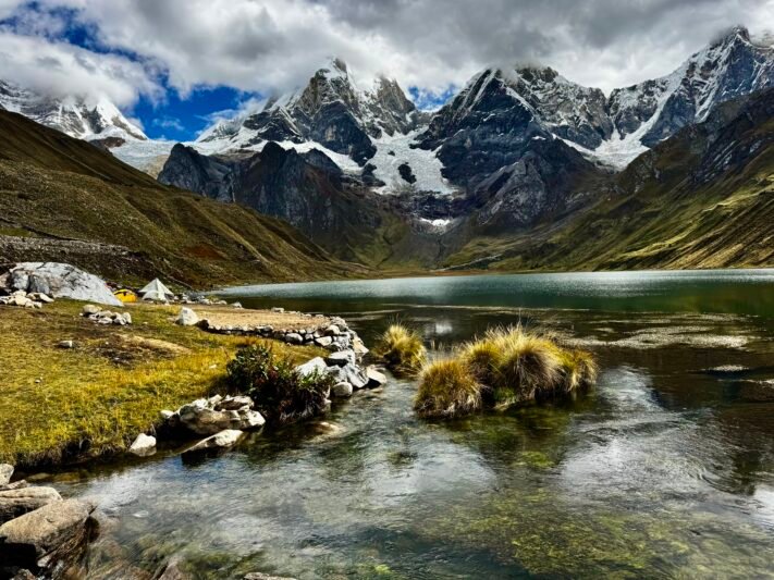
The full circuit loops around the entire range, creating a special opportunity to develop a deeper, more complete understanding of the stories these mountains and valleys hold. To move through the range, you cross pass after pass above 4,500 m / 14,800 ft and camp beside glacial lakes in colors you won’t believe until you see them. From typical glacial-silt grey to Caribbean turquoise, they run the gamut. On a calm day, you’ll get lucky enough to see perfect reflections of the sharp, snowy mountains glimmering across their surface.
And somehow, the cherry on the cake of this range isn’t the views themselves. It’s the fact that this magical land, where every single view makes you want to pull out your camera, has been home to the Quechua people for generations. They were farming and herding this land long before word spread to the camera-carrying public – and they still live there. Each camp on the circuit is maintained by its respective community, which is why there’s a fee at each camp. Coming to understand these people and their relationship to this land offers an unexpected mental and emotional shakeup, reminding you of what’s important and connections you want to renew in your own life.
If all of that isn’t enough to pique your curiosity, Siula Grande holds one of mountaineering history’s most famous stories of survival. If you haven’t heard of Joe Simpson’s Touching the Void, it’s an unbelievable story of big-mountain reality, resilience, and an unwavering desire to live.
The Huayhuash Circuit: How Many Days Do You Need?
There are a few ways to hike the Huayhuash, and each one trades time for experience.
The shorter versions are easier to fit into a vacation, but you miss some of the biggest moments. The full circuit gives you the complete loop, but once you add acclimatization and travel, it adds up to about three weeks away from home.
The itinerary in this article is a partial route, Cuartelhuain to Huayllapa, and in my opinion, it’s the best mix. In five trekking days, you get the eastern and southern arc of the range, which is where the giants live: Jirishanca, Carhuacocha, Tres Lagunas, Siula Pass, Trapecio, and the San Antonio panorama of Siula Grande and Yerupajá. You still have time to acclimatize properly, and the whole trip fits into about two weeks, which is easier for most working professionals.
(Weighing your options? I compare them in more detail, along with when to go and whether to hike guided or on your own, in this article).
The Huayhuash Circuit: A Day-By-Day Breakdown
Here’s what our days look like, plus a few stories from our last expedition along the way. Remember that distances and times are approximate, as they shift with the group, the weather, and how many times you stop to stare at the mountains (which can be a lot).
Day 0: Flying to Lima, The Gateway to the Peruvian Andes
Sleep: Lima airport
Fly from home to Lima. The hard news: it’s likely going to be a long flight, with a very late or very early arrival. The good news: the airport has excellent sleep pods (about $30 USD), and they’re totally worth it so you don’t have to leave the airport while you wait for your connection to Huaraz. Rest up, you’ve got big days ahead!
The flight from Lima to Huaraz is under $100 and about an hour long. It leaves daily in the early morning, and twice a week there’s a late-morning flight that gets you into Huaraz right around lunchtime. You could take an 8-hour overnight bus for half the price, but considering the physical demands of the circuit and the number of days the trip requires, I think the flight is an investment that pays off.
Day 1: Lima to Huaraz, Peru’s Trekking and Climbing Capital (3,000 m / 9,843 ft)
Travel: 1-hour flight | Sleep: Hotel in Huaraz
If you arrive into Huaraz by plane, the first view will make you downright giddy. The airport is super small, so you land in an open area and they roll up the stairs for you to walk off the plane. As you step out onto the stairs and turn your head… you’re gonna get stopped in your tracks.
It’s Huascarán, Peru’s tallest mountain, towering on the tiny airport’s horizon.
It feels like the ultimate premonition of what’s to come.
Huaraz is the mountain town that serves as base camp for the Cordillera Blanca, the Cordillera Negra, and the Huayhuash. After flying all morning and the day before, you’ll be tired and will likely need a nap before heading out for dinner and some town exploration. There are quite a few places to exchange dollars for soles, pick up last-minute gear, and eat abundant, tasty food.
Make sure to not let the excitement push you into doing too much, or the accumulated “tired” send you straight to the hotel bed to call it a day. Your job on this first day is to arrive and let your body start adjusting, which means a balance of light walking, nutrition, hydration, and sleep.
Pro tip: eat a lighter, more familiar meal on this first night. Huaraz is already at significant altitude and, on top of travel stress and poor sleep, your body is doing a lot of work. Peruvian food is delicious, but avoid anything that’s hard to digest, like a big steak or a heavily seasoned meal. Eat carbs, moderate protein, and drink lots of (bottled) water.
Days 2 – 4: The Important Work of Acclimation
On the Huayhuash, how well you acclimatize matters more than how fit you are. That’s why the first few days are spent hiking around Huaraz, which sits in the middle of pure mountain magic, so these hikes feel like part of the adventure, not just a means to an end. Each one goes a little higher than the last, and you come back down to sleep in town.
(Want the full why and how of acclimatizing? I break it down in this article).
Laguna Wilcacocha Acclimatization Hike (3,745 m / 12,287 ft)
Distance: ~7 km / 4.3 mi round trip | Elevation gain: ~550 m / 1,800 ft | Time: 4–6 hours with a long lunch | Sleep: Huaraz
Our first hike climbs into the Cordillera Negra to a quiet lagoon with a view straight across the valley to the snowy giants of the Cordillera Blanca. We take a long lunch and even make time for a nap at the top, so our bodies ease into working at altitude. From our lunch-and-nap spot, we can see Huaraz and where the Cordillera Negra and the Cordillera Blanca converge. Gorgeous!! Another cool part of this hike is that we literally walk up into and through a local community, which helps us start to process the human side of the trip and learn about the people who call this special place home.
Laguna Churup Acclimatization Hike (4,450 m / 14,600 ft)
Distance: ~7 km / 4.3 mi round trip | Elevation gain: ~600 m / 2,000 ft | Time: 4–6 hours | Sleep: Huaraz
A step up! We move higher for our second hike, and the trail is steeper. There’s a short rocky section near the top, which helps us start to practice our footing on uneven ground. Laguna Churup is a turquoise lake tucked right under the face of Nevado Churup. We take a long lunch at the lagoon, then head back down to sleep low in Huaraz.
Tale from the trail: When I say the acclimation hikes are an experience of their own, I’m not exaggerating. On our last expedition, we took so many photos on these first hikes that some people had to go back and delete a few to free up space. The big nevados (the glacier-covered mountains) peek over the horizon and over people’s homes, gardens, and crops, and there’s a picture everywhere you look.
Flexible Acclimatization Day in Huaraz
Sleep: Huaraz
This day stays open on purpose. Depending on what our bodies need and how they’ve been reacting to the altitude, we might go on one last acclimation hike, choose a more leisurely sightseeing option, or simply bum around Huaraz. We decide together, based on what will best support everyone’s acclimatization. We also get our duffels packed and ready for the trail!
Pro tip: There are many other famous acclimation hikes, including Laguna 69, but many require 3–4 hours of driving each way. The views are killer, but that much time in a vehicle can wear on your body and mind. It also means waking up earlier, eating dinner later, and a whole array of small details that can affect how well your body acclimates. So having a strong understanding of acclimation, and being able to read how your body is doing, is critical for making the best decisions for you.
Day 5: Cuartelhuain to Laguna Mitucocha via Cacanan Punta (4,650 m / 15,256 ft)
Distance: ~9 km / 5.6 mi | Elevation gain: ~680 m / 2,230 ft | Time: 4.5–5 hours | Sleep: Camping
The pickup arrives just after dawn. It’s early but excitement is high because you’re finally heading to the main show. The hard news: the ride is 4–5 hours. The good news: most of the drive is on paved road so you can keep sleeping… although each time you open your eyes, you’ll have to resist the urge to look out the window.
Hopefully having rested some, you stop for a full breakfast in Pocpa before finishing the last stretch of the ride.
Finally, you arrive at the trailhead: Cuartelhuain. The sign at the stop spells it differently, as does the map, but have no fear, they’re all the same place. The camp names are in native Quechua, but the Spanish spelled them phonetically when they arrived, so wherever you look, the name may be a little different. Here you meet your arrieros and their mules and donkeys, as well as the logistics team that will accompany you for the rest of the trip.
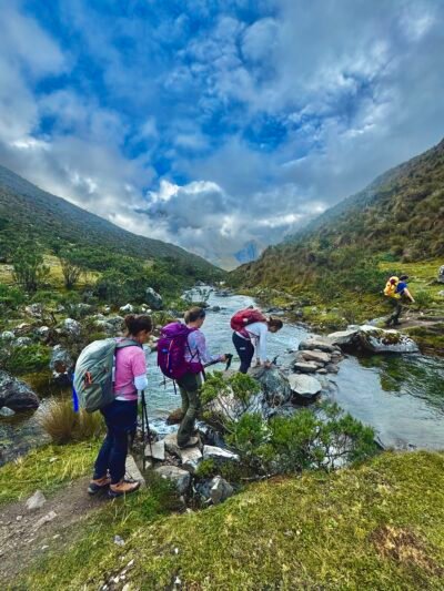
Your first pass, Cacanan Punta, is short, but the push feels like one of the hardest, just because your body is starting to get into the new rhythm. You’ll likely need to stop more often and your heart will beat harder than you likely have felt before, which can be scary if it’s a new experience. Walking at high altitude is an art of pace-setting.
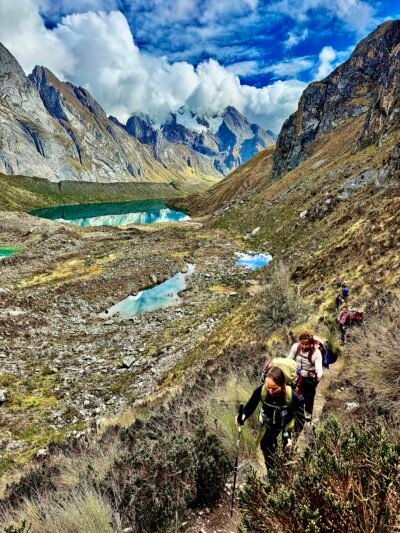
From the top, the valleys, lakes, and peaks of the Huayhuash open up for the first time, and you descend to a dreamy camp right below the sharp face of Jirishanca.
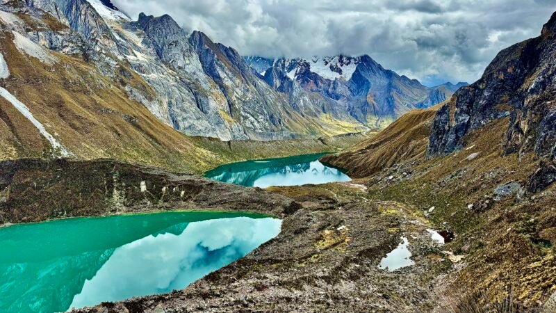
Day 6: Laguna Mitucocha to Laguna Carhuacocha, the Iconic Huayhuash Camp (4,700 m / 15,420 ft)
Distance: ~10 km / 6.2 mi | Time: 4–5 hours | Sleep: Camping
A lighter day over Carhuac pass, with more big peaks coming into view. There are a few ways you can hike this day, from the preferred slightly longer and steeper version over the pass to a “stay down in the valley” option if the altitude is hitting harder than you’d like.
Throughout the day, you’ll stop at celeste alpine lakes to take pictures, and have lunch beneath massive glaciers toppling over the pointy peaks. At one of the lookouts, you can see several alpine lakes lined up one behind another. Above them sit perfect glacial bowls, and the lakes rest in precisely formed circles. It’s a window into how this place looked when those bowls were still filled with snow and ice, heavy enough to shape the land beneath them.
Along the way, you’ll pass huts and pastures of the local community, and get a glimpse of how people have lived here – and in some places still live – while taking care of this land and their animals.
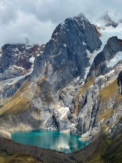
You’ll eventually arrive at Laguna Carhuacocha, and honestly? Although you probably didn’t think anything could get prettier than your last camp, you will find your mouth wide open. Yerupajá, Siula Grande, and Jirishanca rise right out of the lake. (Remember that sunset from the beginning of this article? This is where it happened.)
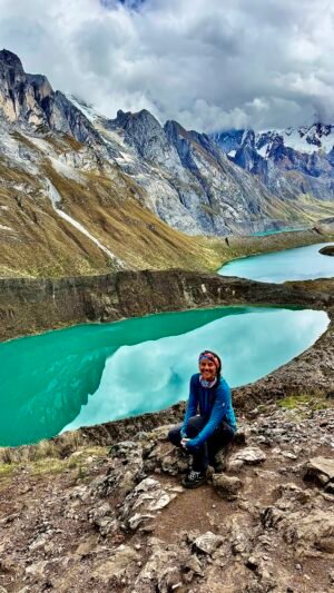
Day 7: Carhuacocha to Huayhuash Camp via Tres Lagunas and Siula Pass (4,800 m / 15,748 ft)
Distance: ~12–15 km / 7.5–9.2 mi | Elevation gain: ~800 m / 2,600 ft | Time: 5.5–6.5 hours | Sleep: Camping
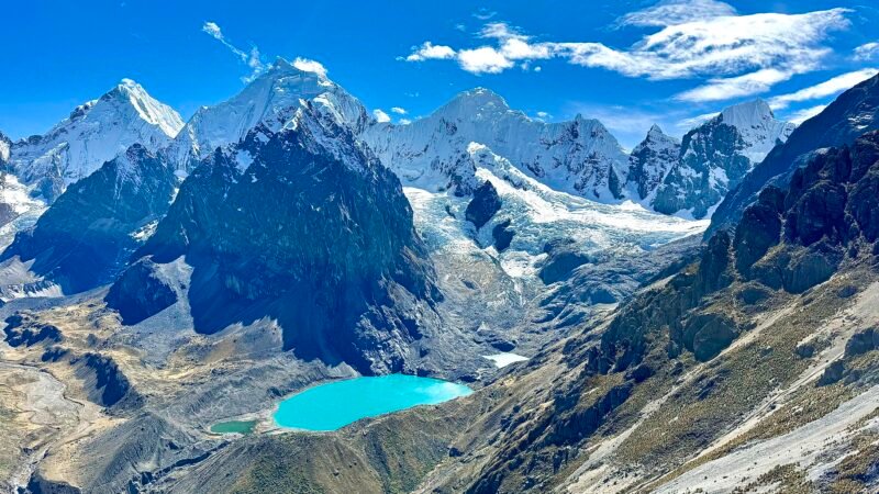
A showstopper of a day. You walk the lakeshore, next to a glass-like reflection of the mountains, and climb onto a glacier moraine. The path is steep up to the Mirador Tres Lagunas, a lookout over three glacial lakes in three different shades of blue, with Siula Grande towering above. I recommend stopping here for an excessive amount of pictures, because every angle feels special and you want to somehow capture the feeling soaring through your soul. I like to take a long pause to snack, hydrate, and simply be in this place. It’s hard not to reflect on how it was created, and how it has transformed over the past decades.
You continue climbing to Siula Pass, slow and steady, and the views from the top are worth every hard to take breath.
Tale from the trail: On our last expedition, as we sat at the pass admiring Siula Grande, Fernando, our mountain chef, told us about climbing it 30 years ago, when he was a young assistant mountain guide. We stared at the mountain, which looked impossible to climb, searching for a line that felt doable. We couldn’t find it, as the receding glacier has erased the line they used. But in his quiet, humble voice, Fernando showed us how they moved up the mountain, where the crux was, and how they came down. We sat there in a mix of admiration for what Fernando had done decades ago, nostalgia for how the mountain has changed, and awe for the power still standing in front of us. It was hard to close that moment, but the wind at the pass was strong, so we finally decided we were rested enough to continue on.
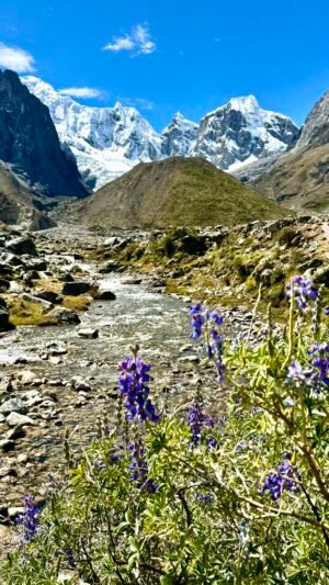
A long descent, with a welcome lunch break out of the wind, brings you to Huayhuash camp. Here you get a special treat, especially if it’s a sunny day: a dip in the river!
Tale from the trail: Faster than we could tell Fernando and Soyla that we’d arrived, the majority of our group had excitedly already taken off their boots, grabbed their towels and shorts… and booked it to the river. You can tell it’s snowmelt by the immediate goosebumps upon dipping your toe in, but fresh water feels oh so good. After rinsing off a couple of days of sweat, we laid on the ground, talking, laughing and soaking in the sun, feeling fresh, clean, and oh so happy.
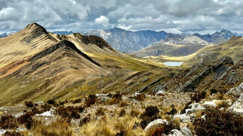
Day 8: Huayhuash Camp to Elefante via Trapecio Pass, First Pass Over 5,000 m (16,404 ft)
Distance: ~11 km / 6.6 mi | Elevation gain: ~750 m / 2,460 ft | Time: 5–5.5 hours | Sleep: Camping
The climb to Trapecio passes right in front of the Jurau glacier. Having this massive hanging glacier at what feels like arm’s length is too special a moment to hurry by, so I highly recommend to take a break and take in the view before continuing on to the pass. At around 5,000 m / 16,400 ft, it’s the first time many people have ever stood this high.
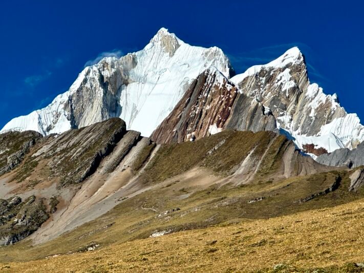
The wind blows fierce right on the pass so you’ll likely need to get down a bit further and into a more protected place before you can fully enjoy the surprising view from the other side. It looks like a different planet. The grey, jagged mountains you’ve been surrounded by quickly shift to a sandy, smooth rock.
The camp this night is called Elefante, which gets its name from a huge rock right in the middle of it. Try to find the elephant! On our last trip, half of us saw it head-on, and the other half saw it from the side.
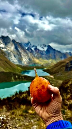
Day 9: Elefante to Huayllapa via San Antonio Pass (~5,050 m / 16,570 ft), Views of Siula Grande
Distance: ~17 km / 10.5 mi | Time: 7–9 hours | Sleep: Huayllapa village
One last big climb to San Antonio pass, for one of the most breathtaking panoramas of the whole trek: ice-blue lakes below Siula Grande, Yerupajá, and Siula Chico. It takes about 1.5 hours to reach the top, walking over an exhausting loose gravel, so arriving feels like a celebration. It’s your last pass, the view is even more than you expect, and it wasn’t easy to get there.
Tale from the trail: On our last expedition, we pulled out our flags, took pictures, and hugged each other with a pride that only comes from living something so deeply that words will always fall short, but you know exactly what the other person is feeling.
The first half of the descent is steep, exposed, and requires full attention, but with careful footing and help from strong guides, you can take it step by step. Getting to the bottom takes longer than expected, but the reward is taking off your shoes and briefly cooling your hard-worked feet in the river before continuing on.
From there, it’s a long but relatively flat walk out of the valley and into the very small village of Huayllapa. You’ll get to sleep in a bed, take a hot shower, and toast to a well-earned celebration.
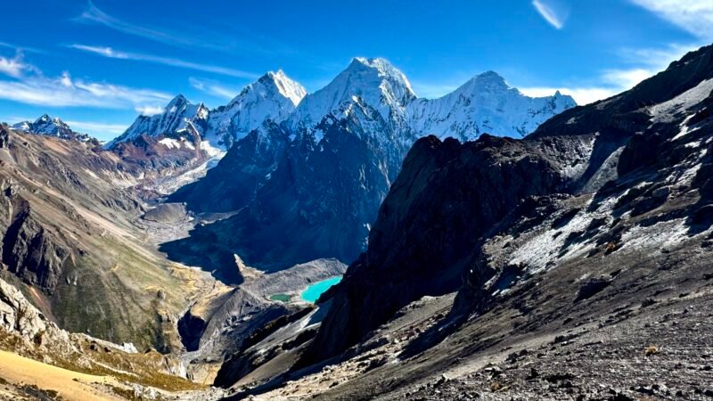
Day 10: Huayllapa to Lima, the Journey Home
Travel: 7–12 hours by sprinter van, with a stop for lunch | Sleep: Lima or overnight flight
After breakfast, we leave around 7am and wind our way out of the mountains and down to the coast, with a stop for lunch along the way. The drive time varies widely, because it depends on traffic getting into, and through, Lima.
I know 7–12 hours sounds like a lot! But it’s actually the most efficient way home. To get back to Huaraz by trail, you’d need to finish the full circuit and still drive about 5 hours. Or you could drive 7–8 hours from Huayllapa to Huaraz, and then fly back to Lima. Heading straight to Lima means one long travel day, but you’re home sooner and don’t have to pay for the additional flight. You can go directly to the airport for a late-night flight, or stay a few extra days in Lima.
Come Walk The Huayhuash With Us!
Our 2027 Huayhuash expedition runs May 13 – 22. Group is capped at 12 to keep it small, so spots are limited and fill as deposits come in. See the full itinerary, dates, and pricing here.
Raphael will be joining us as our photographer, so the pictures are guaranteed to be epic. He’s also early in his own mountain journey, so we’ll be sharing knowledge, tips, and skills along the way, making sure everyone leaves the expedition more capable and confident in the mountains than when they arrived.
Not sure if this trip is the right fit? Book a free Trail Talk call. It’s a relaxed, no-pressure chat where we’ll talk about your hiking experience, how you handle altitude, what you’re hoping to get out of this trip, and whether this is your next adventure.
Wondering whether to go guided or on your own, how to acclimatize, or whether you could really do this? I break it all down here.
What questions do you have about this journey of wonders?
Let me know in the comments!
About the author
Chelsey Berg is the founder of Finding North, where she guides women through life’s turning points with ICF-accredited coaching, adventure retreats, and expeditions in wild places.
Originally from Wisconsin, she has called Chile home since 2012, where the Andes became her playground and her greatest teacher. After 15 years in traditional roles on the corporate ladder, she has found the alignment of life and career + meaning and impact that work for her.
When she’s not coaching or leading adventures for Finding North, she works with NOLS as a mountaineering and backpacking instructor, facilitates leadership development programs for organizations, and leads leadership expeditions for business schools. She believes a life and career you love are one path to design, not two things to balance. You can find her on Instagram at @chelseyberg and on her podcast, By Compass and Soul.